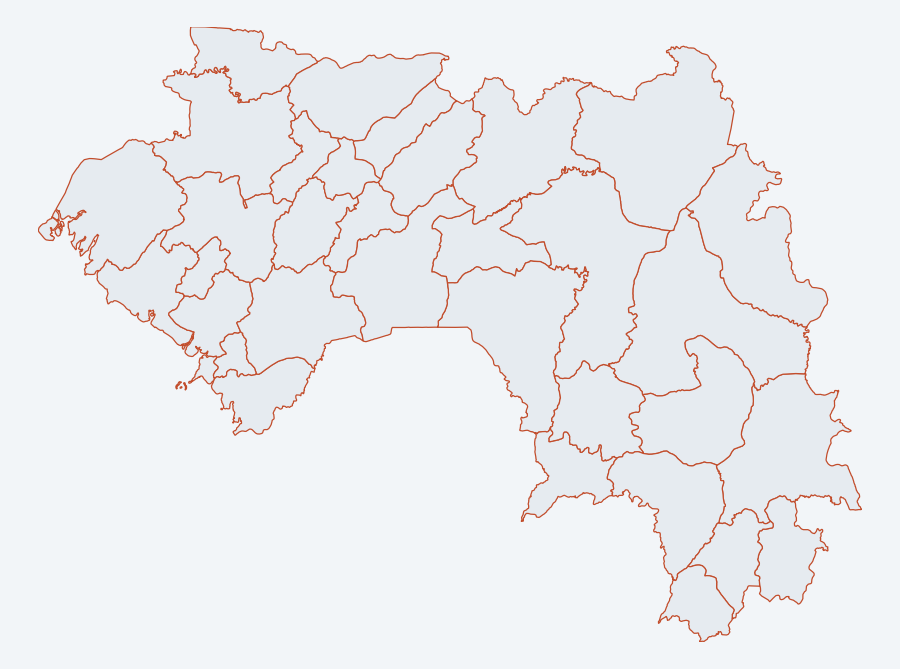
Administrative boundaries, prefectures, Guinea (COD-AB)
Administrative division of Guinea at prefecture level (ADM2), 34 prefectures, COD-AB baseline. Intermediate level between region and sub-prefecture, cartographic support for the solar atlas layers.
Simple
- Date (Publication)
- 2026-09-12
- Citation identifier
- kuma_ouvert:prefectures
- Keywords
-
-
administrative boundaries
-
prefecture
-
ADM2
-
COD-AB
-
Guinea
-
-
GEMET - INSPIRE themes, version 1.0
-
Gazetteer administratif de la Guinée
- Use limitation
-
Open data, reusable with attribution.
- Access constraints
- Other restrictions
- Other constraints
-
CC BY-IGO licence: https://creativecommons.org/licenses/by/3.0/igo/ COD-AB administrative baselines (WFP/OCHA/ITOS). Attribution required.
- Aggregate Datasetindentifier
- d89ceb01-52ef-5c6f-b9bc-7736e22fa9f0
- Association Type
- Cross reference
- Aggregate Datasetindentifier
- 2589d532-fac8-5426-8c33-a5a9aee40480
- Association Type
- Cross reference
- Aggregate Datasetindentifier
- ba6740c3-e2cf-5a7d-81a6-5da8aa1b598a
- Association Type
- Cross reference
- Aggregate Datasetindentifier
- b28af72f-630d-5d93-ac98-32f59eba5b80
- Association Type
- Cross reference
- Aggregate Datasetindentifier
- a1bc196e-11cd-5e41-bc9a-89fde39c6ee6
- Association Type
- Cross reference
- Spatial representation type
- Vector
- Language
-
fre
- Topic category
-
- Boundaries
))
- Reference system identifier
- EPSG:4326
- Distribution format
-
-
GeoJSON
(
RFC 7946
)
-
GeoJSON
(
RFC 7946
)
- OnLine resource
-
kuma_ouvert:prefectures
(
OGC:WMS
)
WMS visualisation
- OnLine resource
-
kuma_ouvert:prefectures
(
OGC:WFS
)
WFS download
- Hierarchy level
- Dataset
- Statement
-
Administrative division of the 34 prefectures of Guinea (ADM2 level), from the COD-AB administrative baselines (WFP/OCHA/ITOS).
- Included with dataset
- No
- Feature catalogue citation
- File identifier
- 6cff48b7-9c38-5710-96fe-eef3ddf81839 XML
- Metadata language
-
fre
- Character set
- UTF8
- Hierarchy level
- Dataset
- Date stamp
- 2026-09-19T12:17:40
- Metadata standard name
-
ISO 19115:2003/19139
- Metadata standard version
-
1.0
Overviews
Spatial extent
Provided by